Police
Configured in
Settings → Crowd-sourced alerts → Police alerts settings section, a SABRE plugin or a crowd-sourced server should be configured for this section to appear.
Police alerts are among the most used and most helpful of all alerts available in the Highway Radar application. There are multiple configuration options available for police alerts. To make these options visible, either the hostname should be configured or a SABRE plugin installed.
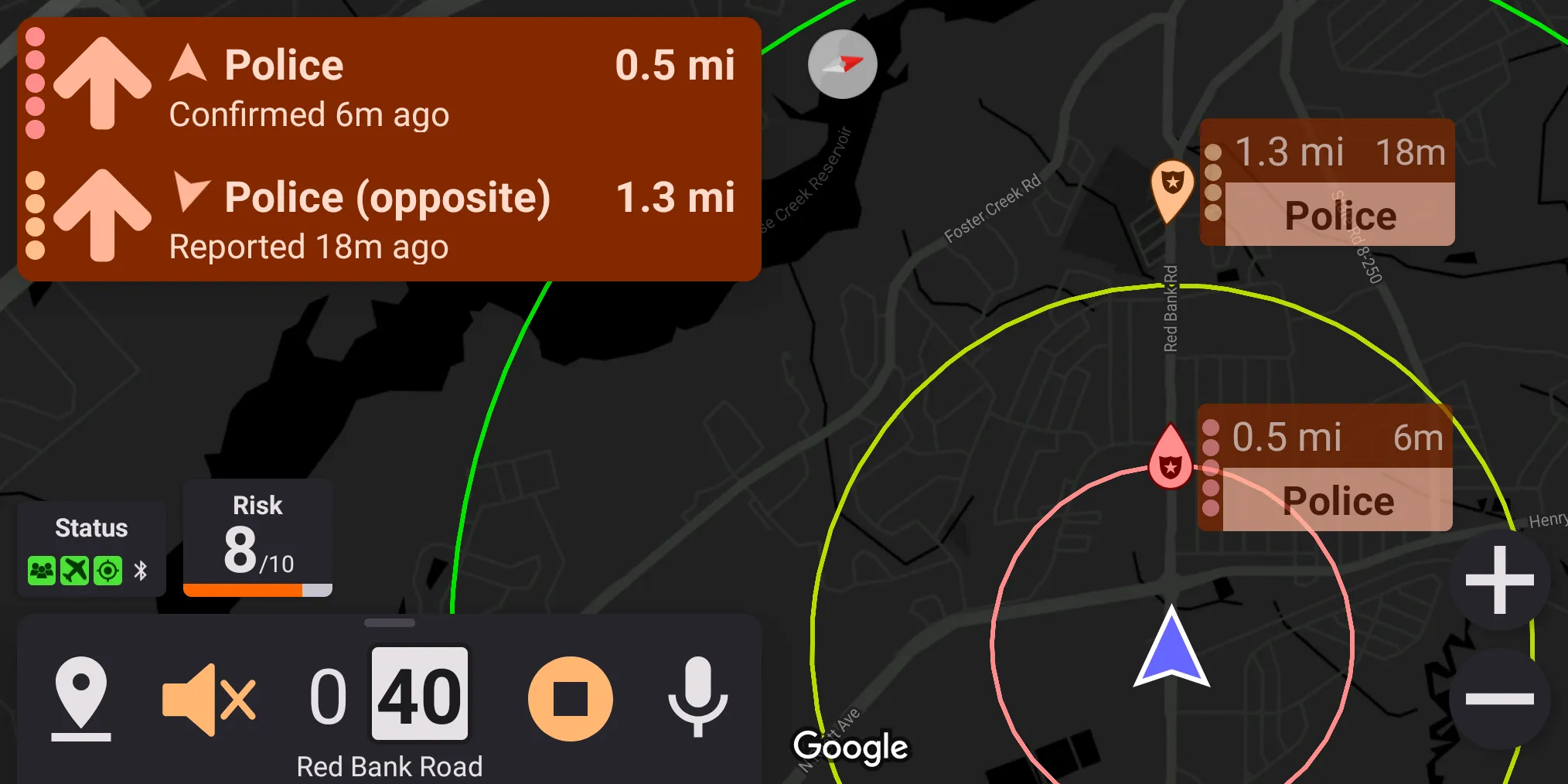
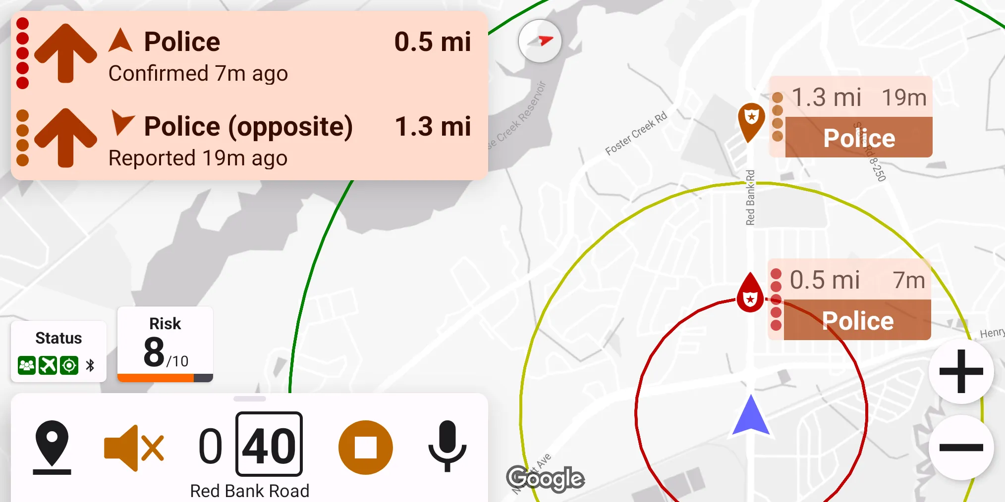
Alerting On Opposite Direction
The "Alert on opposite direction" preference controls whether an opposite police alert should be considered active. We don't recommend disabling this preference as often crowd-sourced reports may contain the wrong enforcement direction (e.g., when camping on a freeway median).
Grouping Close Alerts
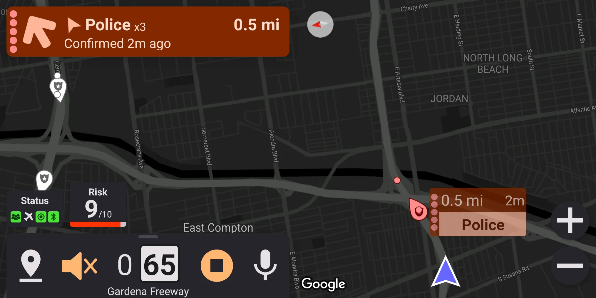
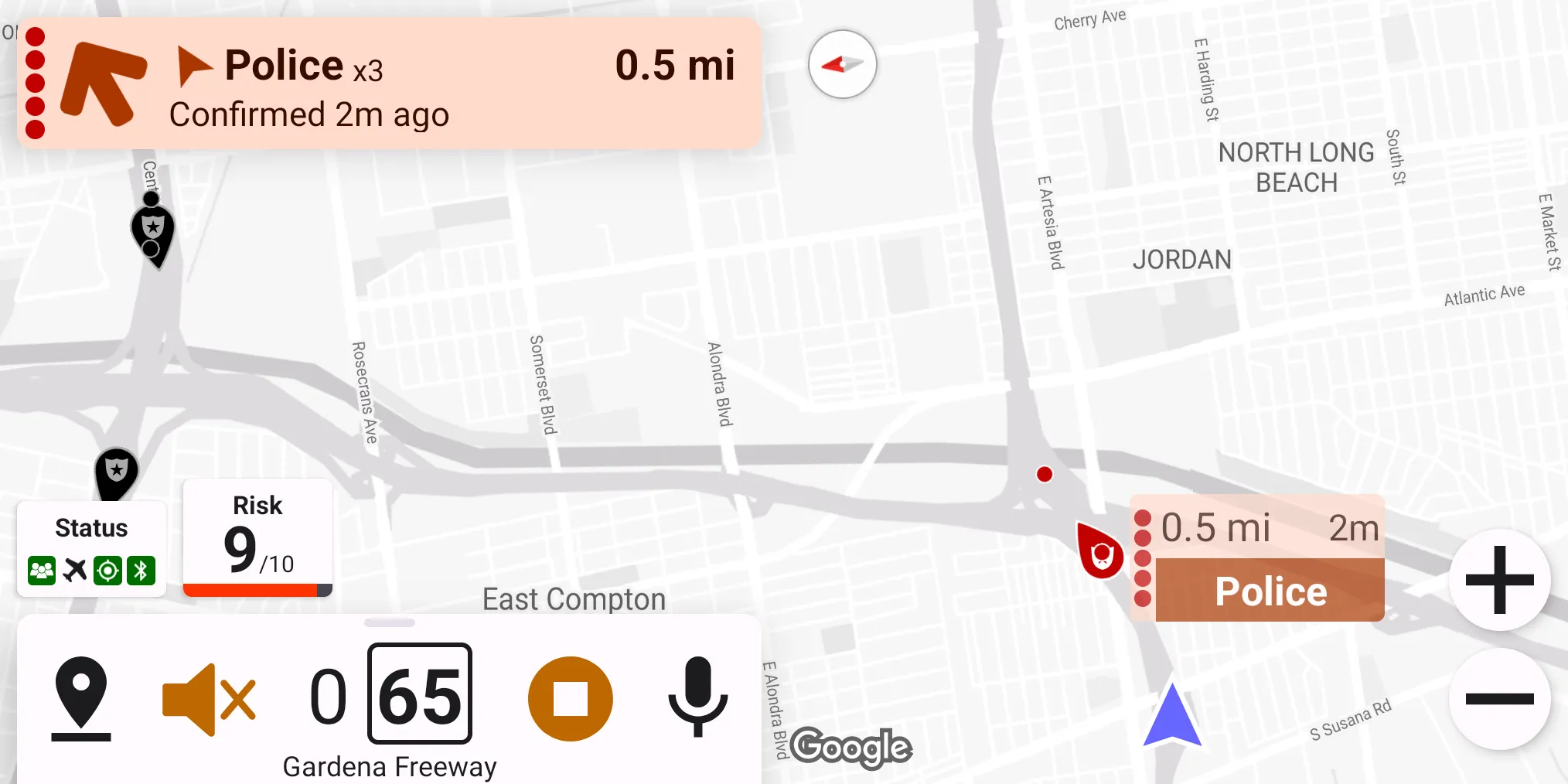
If grouping close alerts preference is enabled, police alerts close to each other can be grouped into a single alert. The alert most aligned with the driver's movement direction is considered a primary alert and displayed as a prominent icon on the map. Other alerts are displayed with small dots.
If a user votes for grouped alerts via SABRE, then the most recent report gets the vote.
Alerting Strategy
Highway Radar can apply special rules for determining whether a police alert is active or not if the alert is located on the same street as the driver.
Method 1: For any alert, it can determine whether it should be active based on the distance and bearing. This estimation method can be configured using three values: maximum alerting distance ahead, maximum alerting distance behind, and maximum alerting distance on the side. For a police alert to become active, it should be within the maximum alerting distance corresponding to its bearing.
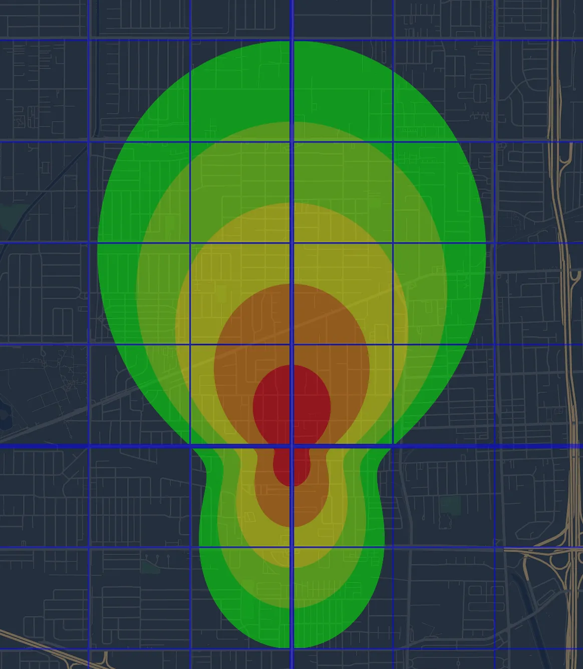
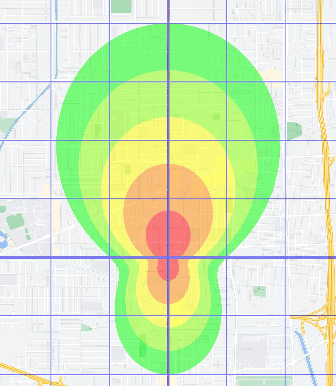
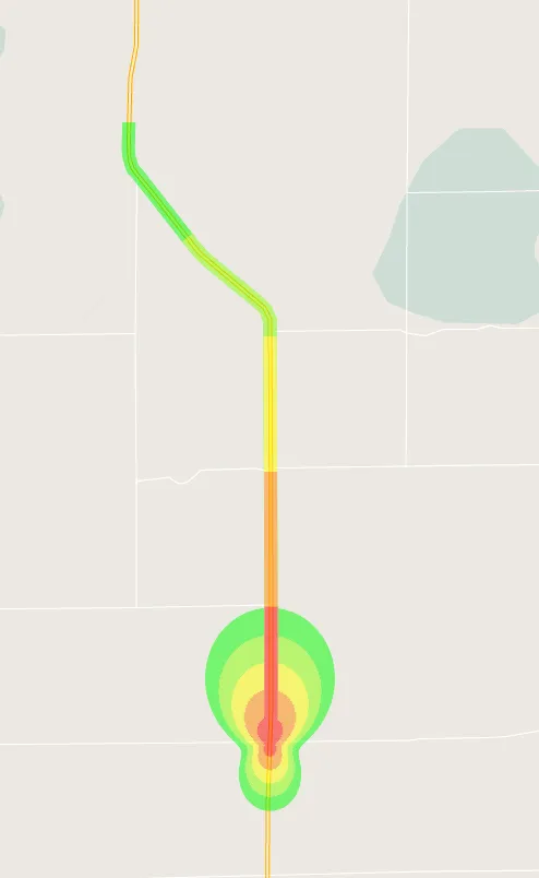
Below is an example of alerting area if the configuration values are set to 2 miles ahead, 1 mile behind, 0.5 miles on the side. A 0.5-mile grid is added for convenience. Different colors show severity levels if "even" algorithm is used (see below).
Method 2: If the police report is located on the same street, another method for determining whether an alert should be active can be applied – a distance to the alert along the street may be considered. An alert is considered active if it is closer than some configured distance (same street maximum alerting distance).
NOTE: An alert is considered to be on a specific street if it no further than 75 meters from the center line of that street. This way alerts on neighbour streets or intersections may also be considered as being on the same street.
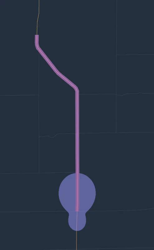
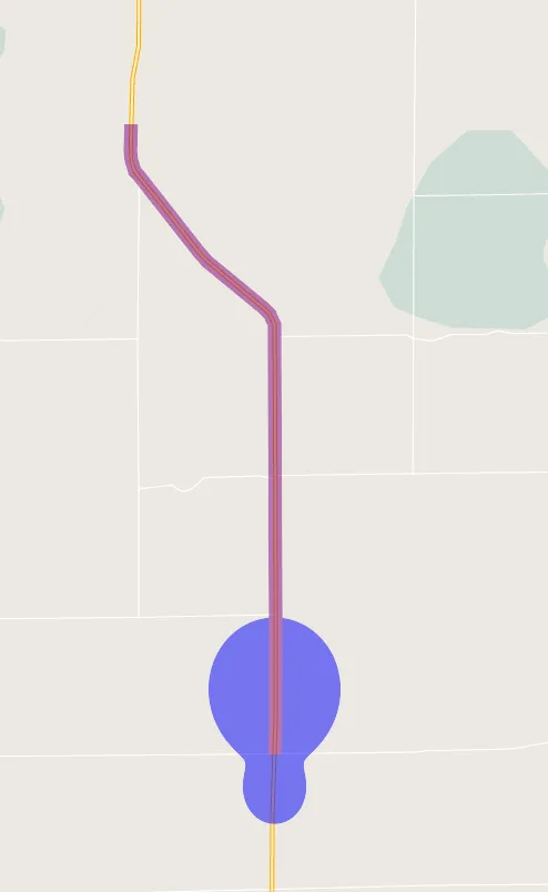
Below is an example of two estimations methods. Blue area corresponds to the alerting area determined using method 1. Magenta corresponds to the alerting area determined using method 2. The right picture shows the alert severity if a combined method is used (see below). Both pictures are shown for 5 miles same-street distance, 1 mile front distance, 0.5 miles back distance, and 0.25 miles side distance. "Even" severity algorithm is used (see below).

Highway Radar allows three ways of combining these methods (called alerting strategy in the preferences)
- Simple – only method 1 is used.
- Same street only – only method 2 is used; however, if the application is unable to find the current street, it falls back to method 1.
- Combined – an alert is considered active if any of the methods above treats it as active.
More details on how the active status and severity are determined, including exact computation formulas, are in the Determining Alert Severity section.
Determining Severity
The alert severity is determined based on the distance to the alert and the maximum alerting distance.
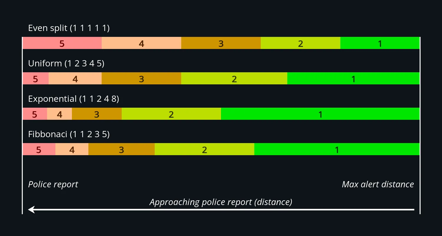
Highway Radar has the following algorithms for determining severity built-in. The table below shows distances as percents from them maximum alerting distance.
| Algorithm | 5 dots | 4 dots | 3 dots | 2 dots | 1 dot |
|---|---|---|---|---|---|
| Even | 0% - 20% | 20% - 40% | 40% - 60% | 60% - 80% | 80% - 100% |
| Uniform | 0% - 6% | 7% - 20% | 20% - 40% | 40% - 66% | 67% - 100% |
| Exponential | 0% - 6% | 6% - 12% | 13% - 25% | 25% - 50% | 50% - 100% |
| Fibonacci | 0% - 8% | 8% - 16% | 16% - 33% | 34% - 58% | 59% - 100% |
Example
- an alert is located at 30° to the right
- there is 1.5 miles to the alert
- maximum alerting distance for 30° is 2 miles
- an even algorithm is used
In this case, the alert is located at 75% of the maximum alerting distance for its bearing (\(\frac{1.5}{2} * 100\%\)), which gives us 2 dots of severity (60% - 80%).
More details are available on how the severity is determined in the Determining Alert Severity section.
Fadeout Interval
Fadeout interval allows hiding outdated police alerts completely. The alert is considered outdated if its report time or last confirmation (whichever is later) is older than a value set with a "Fadeout interval" preference.