Weather Radar
Configured in
Settings → Weather radar.
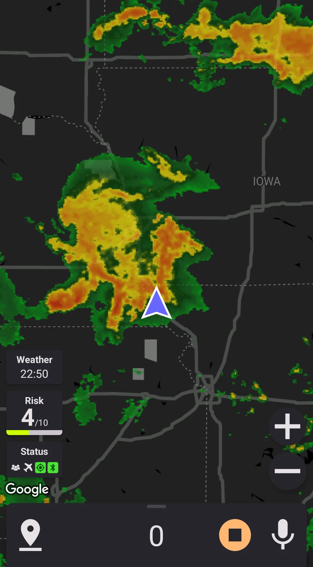
Weather radar and its forecast can be overlayed onto the maps to show the precipitation information.
Data Sources
Highway Radar can pull weather radar data from three different sources
- RainViewer
This is the only source providing weather forcast, currently 30 minutes ahead. RainViewer provides coverage close to world-wide. The quality is average, the service stability is satisfactory. - Raw National Weather Service radar
This data source displays data from the radar as is. It requires very little CPU resources to process; however, is is only available in the United States, there is no forecast, and the radar images aren't cleared from the noise. - Open Weather Maps precipitation map
This is the least accurate data source, and doesn't have a forecast. However, it has a world-wide availability and consumes very little CPU resources. This data source also supports using a custom color scheme, while others stick to the standard radar coloring.
If you know any free or reasonably-priced (less than $25/mo) weather API supporting precipiration radar forecast (aka NowCast), please let me know at [email protected].
Overlay Opacity
The weather radar layer can have different opacity depending on your preference. The opacity level is configured in the preferences.
Zoom
If the correspontion preference is enabled, the application can zoom out the map when the weather radar is enabled. It allows to observer a larger area. When zooming out is enabled, an additional preference is appeared – the map range. The map range value denotes the distances from one side of the map to another along the shorter edge. Them the map is zoomed out, all alerts are removed from the map until the weather radar layer is disabled; however, audible notifications aren't disabled.
Forecast Type (RainViewer Model Only)
Forecast type preference controls how the forecast is presented. Conceptually there are 3 different ways to present it:
- Forecast at a given time – For example, weather radar forcast in 30 minutes, or weather radar now
- Speed-based forcast – Each location on the map shows a different forecast depending on the distance to that point and the speed
The type of the forecast you speed is shown in the top right corner.
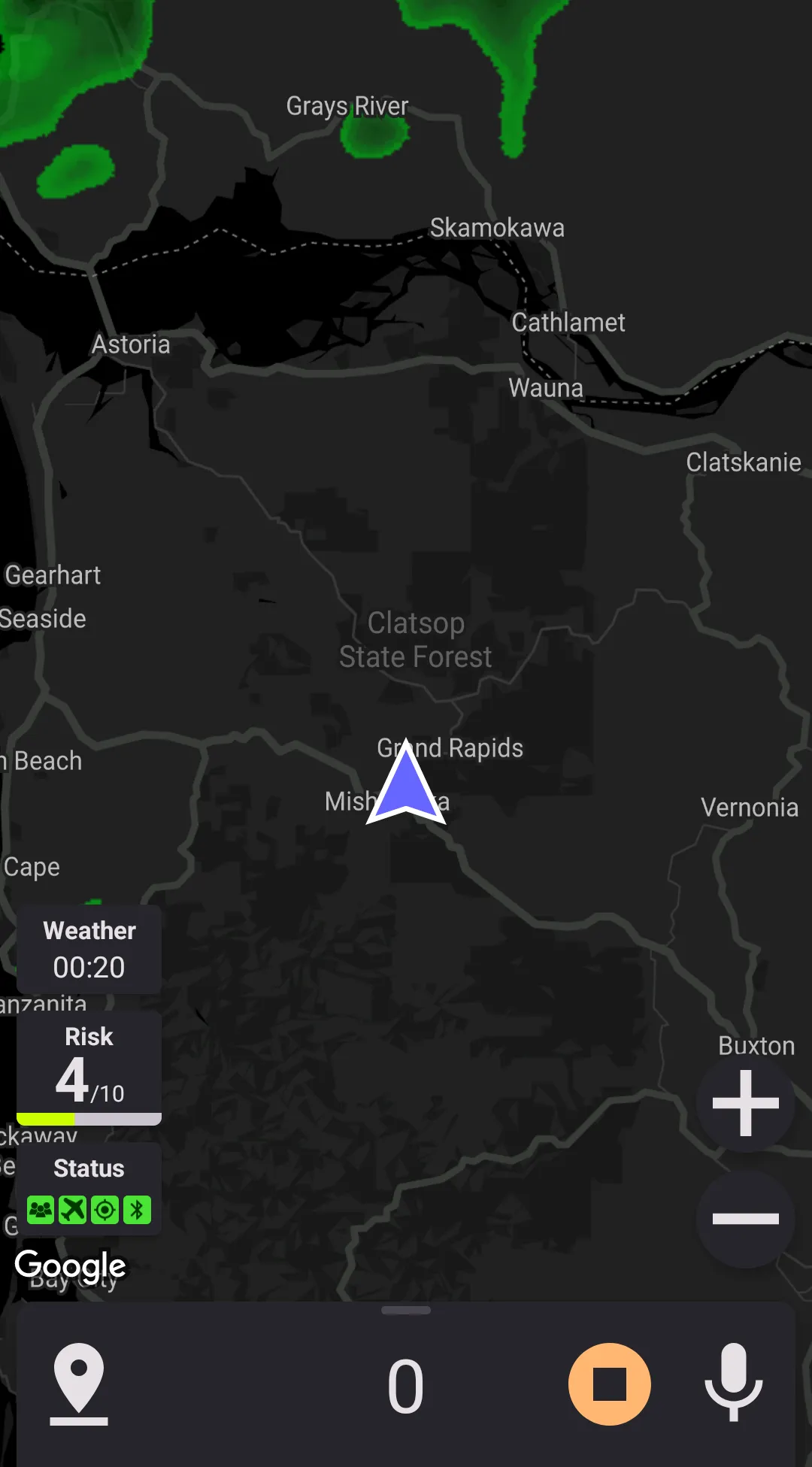
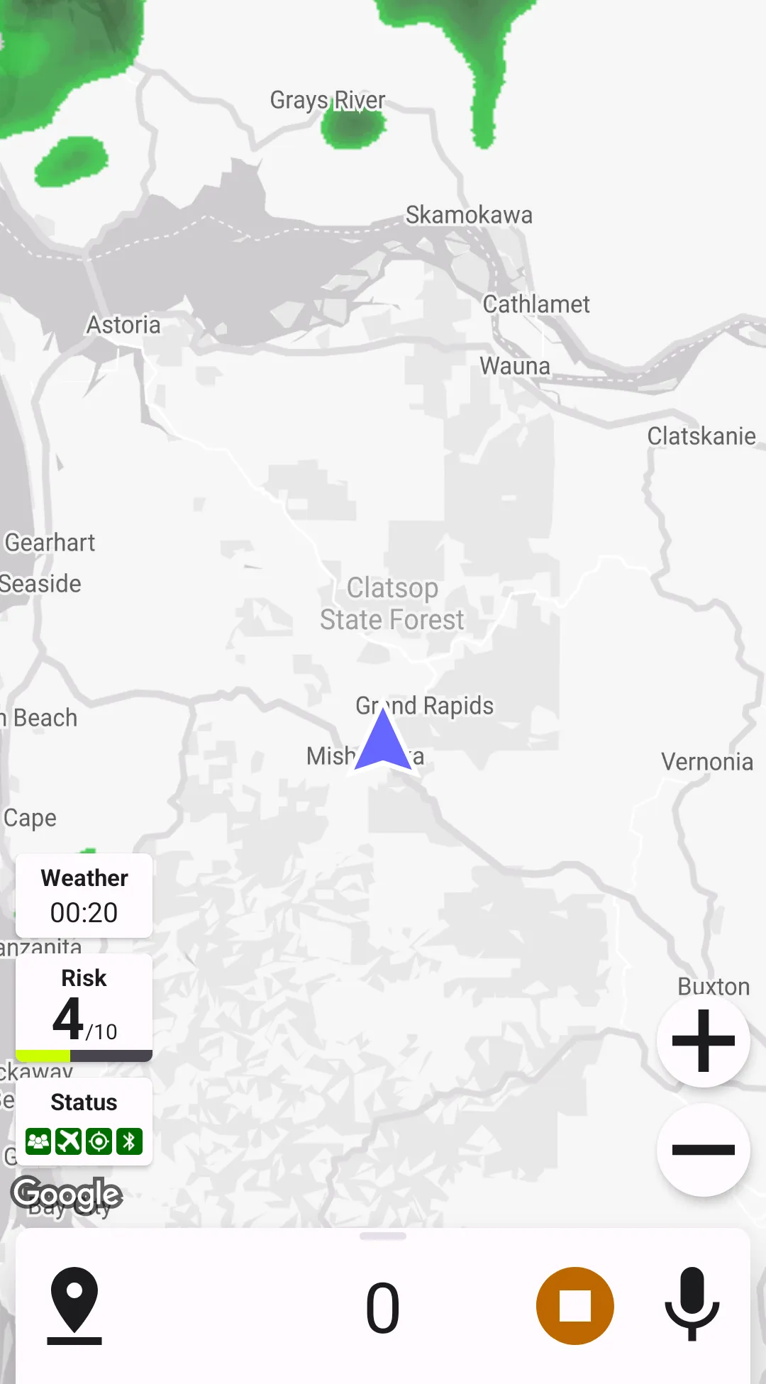
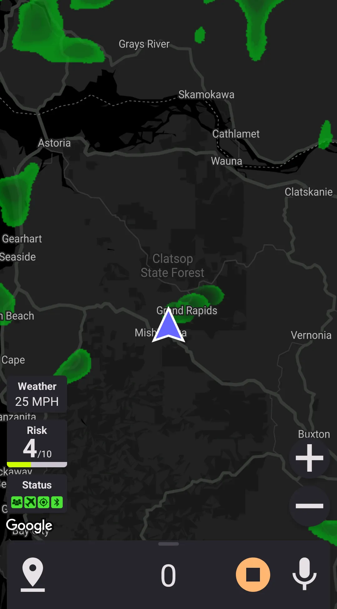
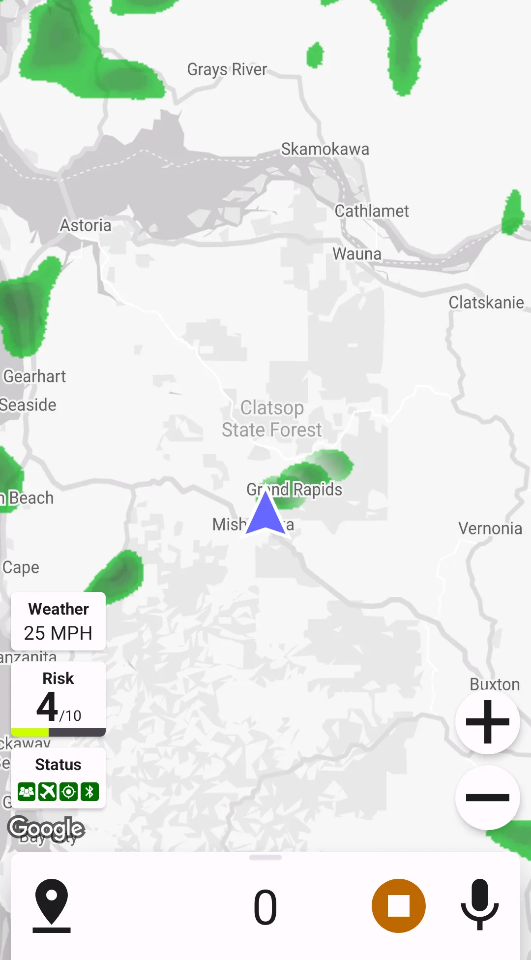
Speed-Based Forecasts
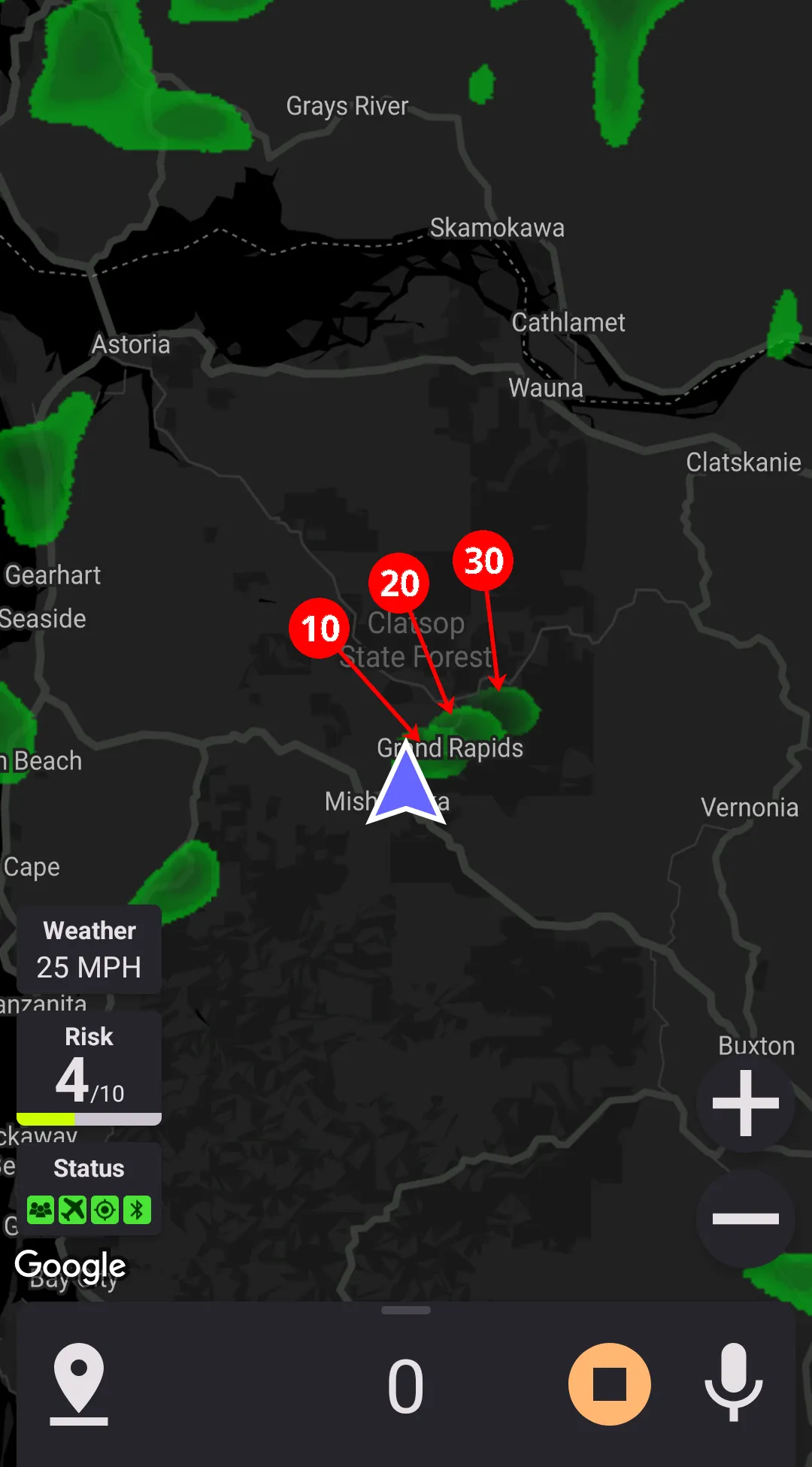
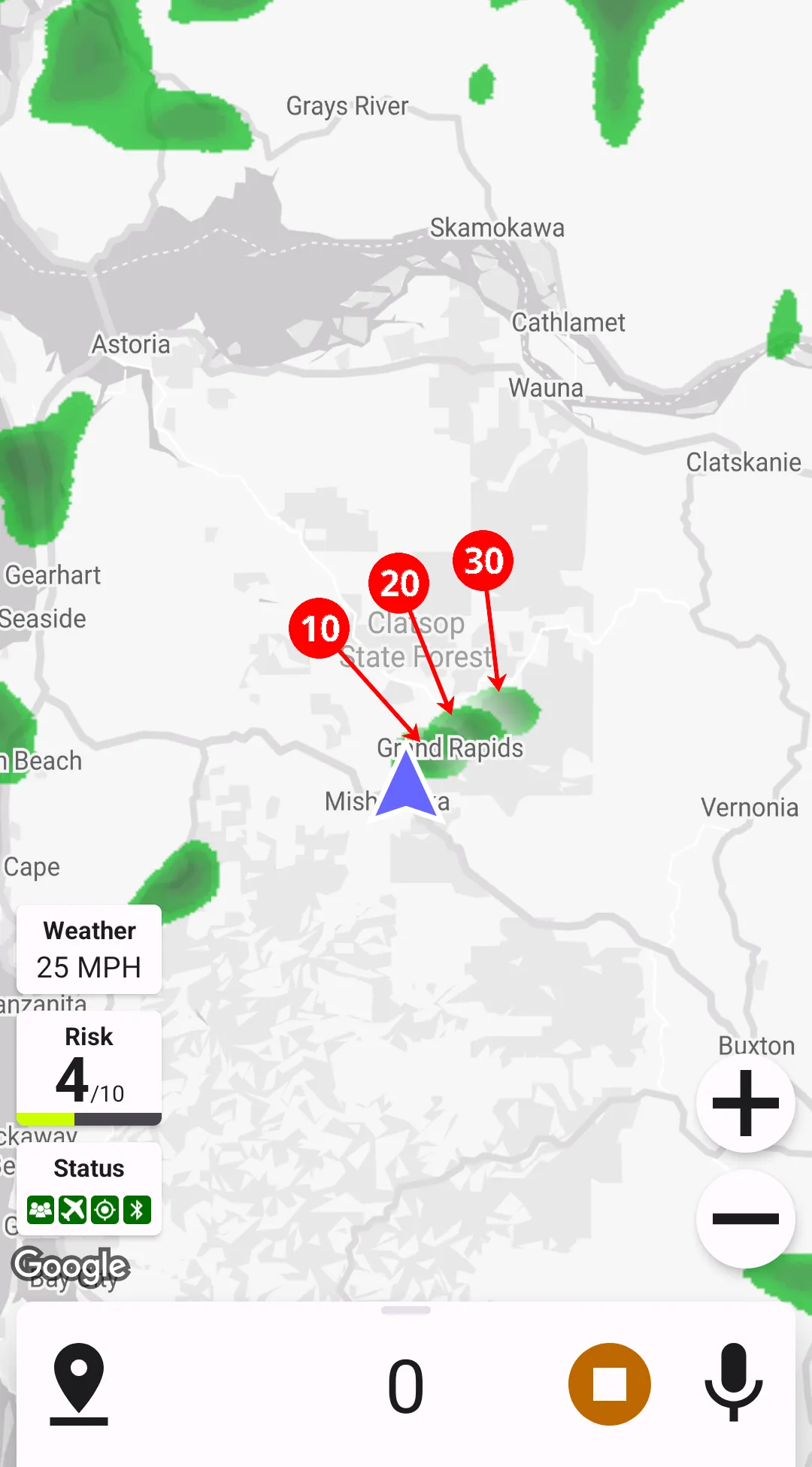
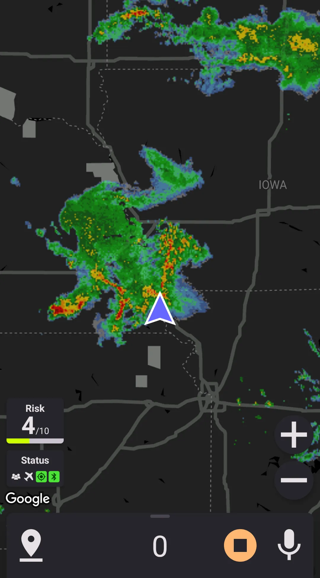
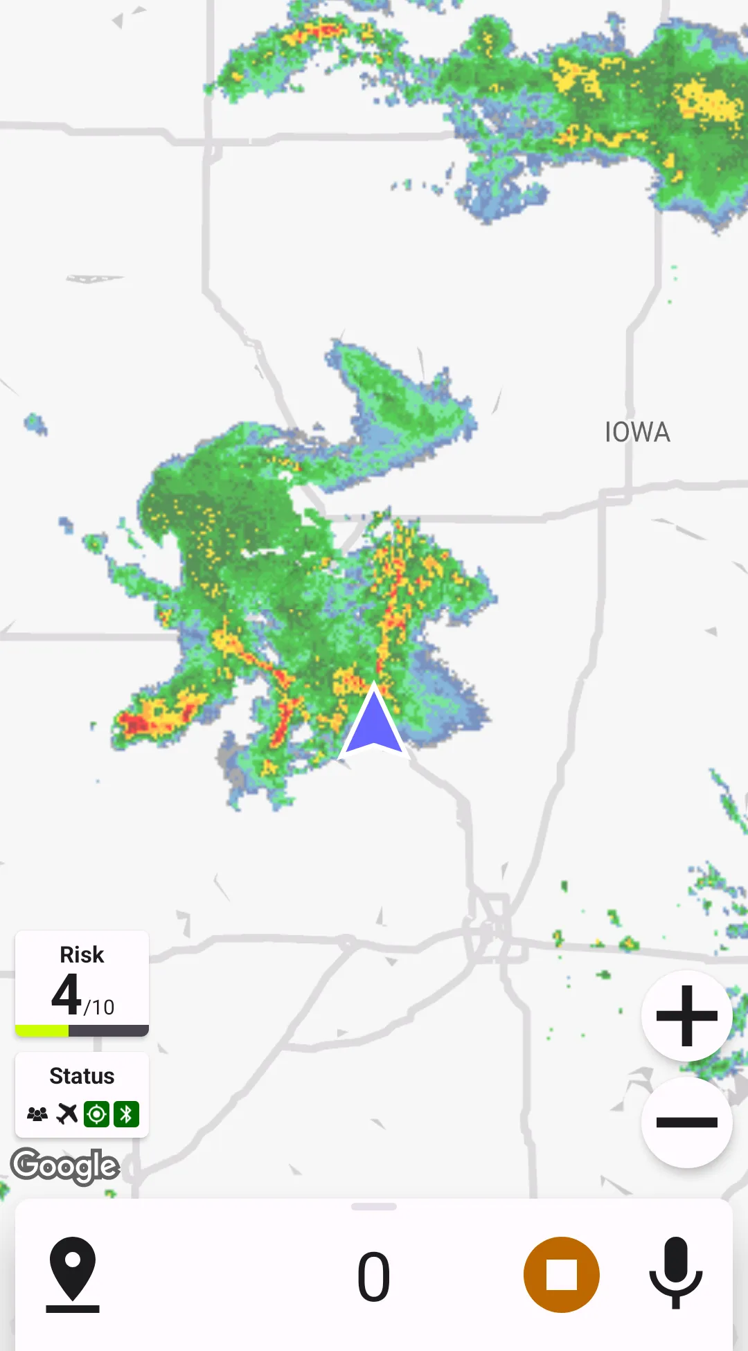
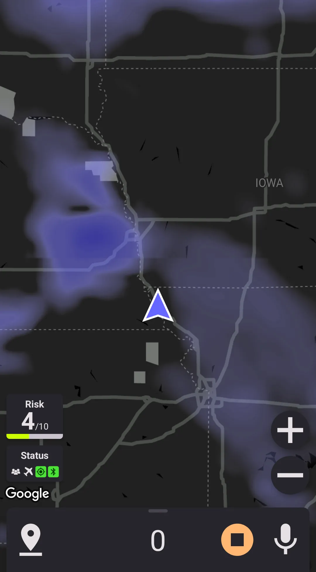
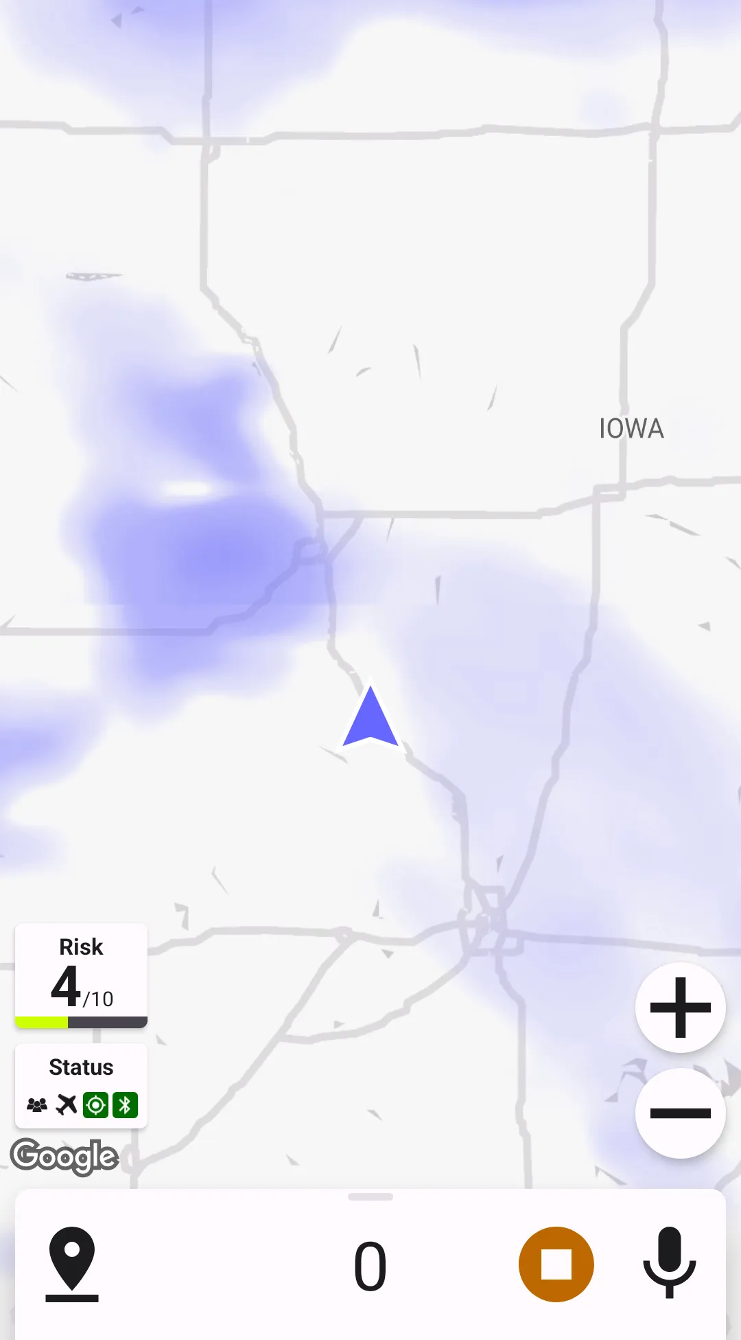
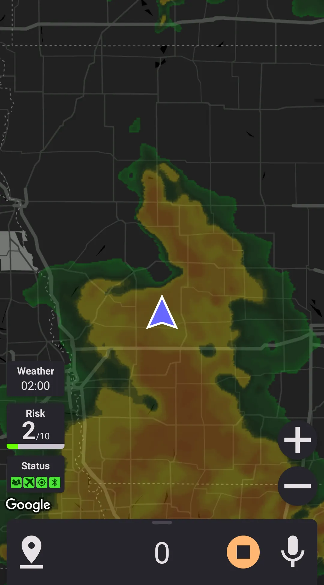
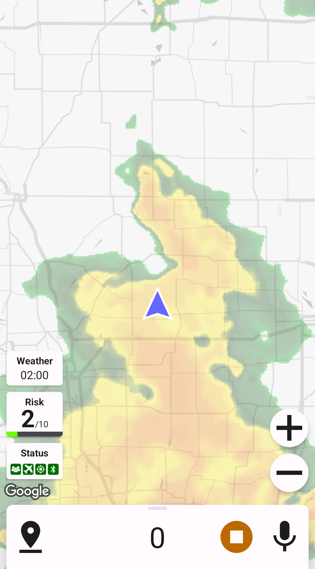
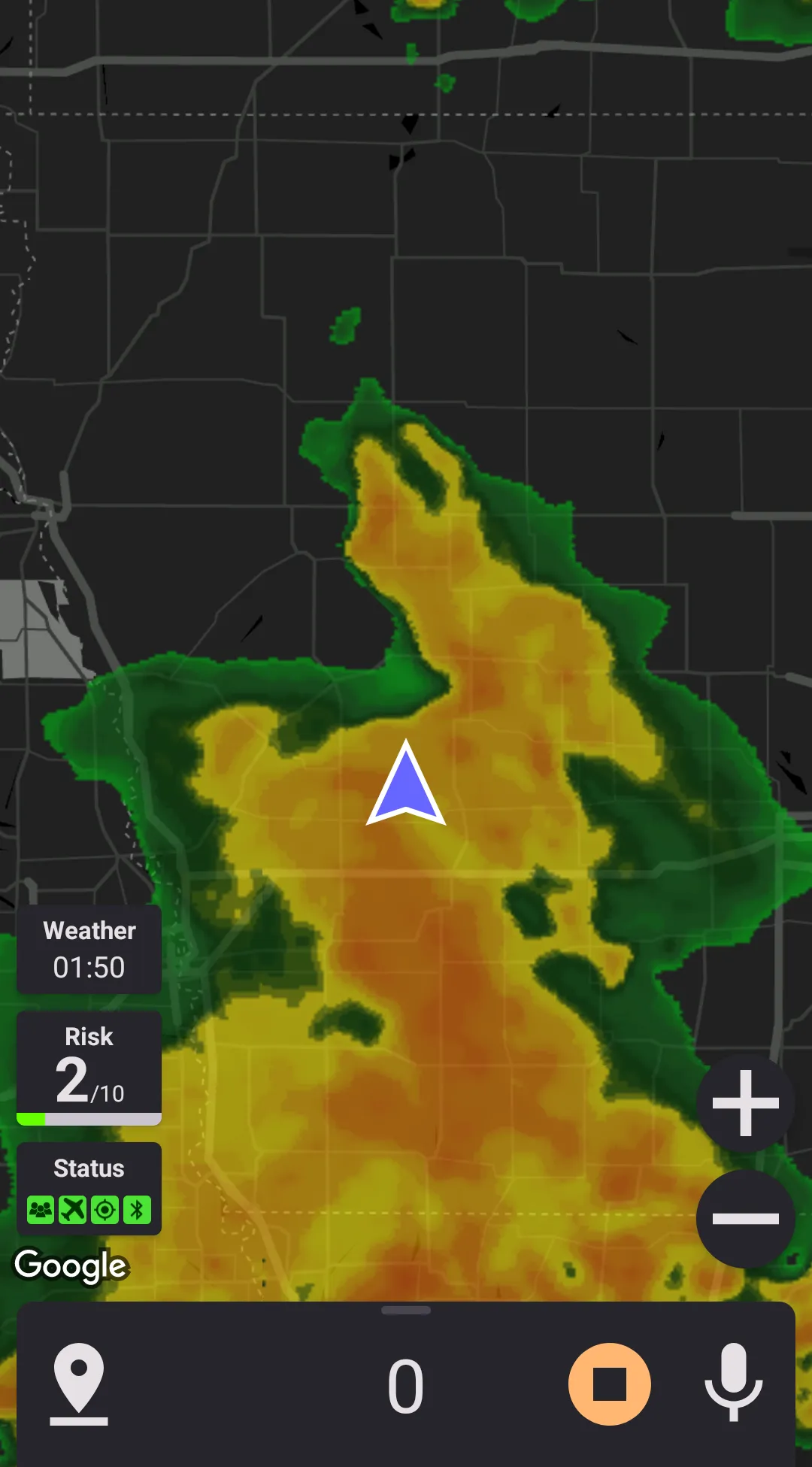
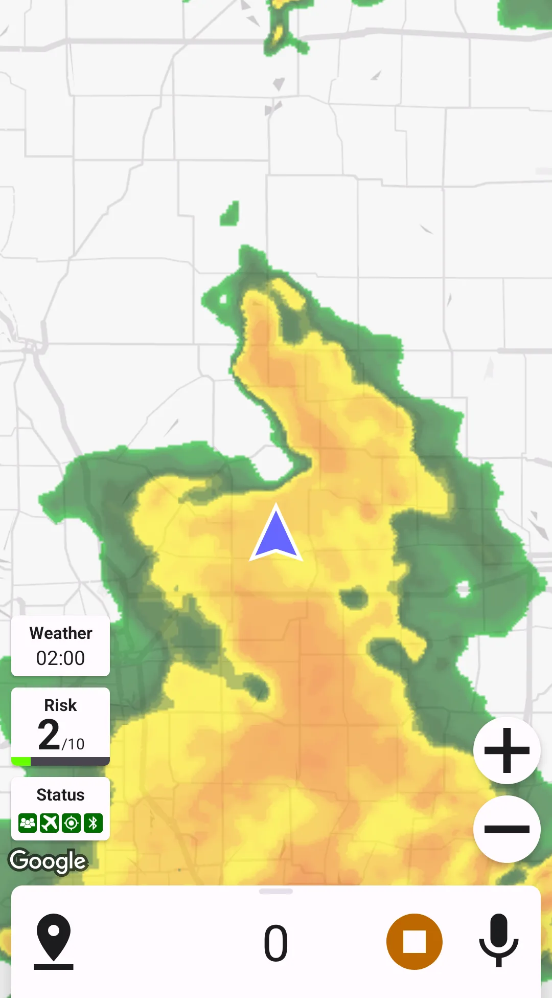
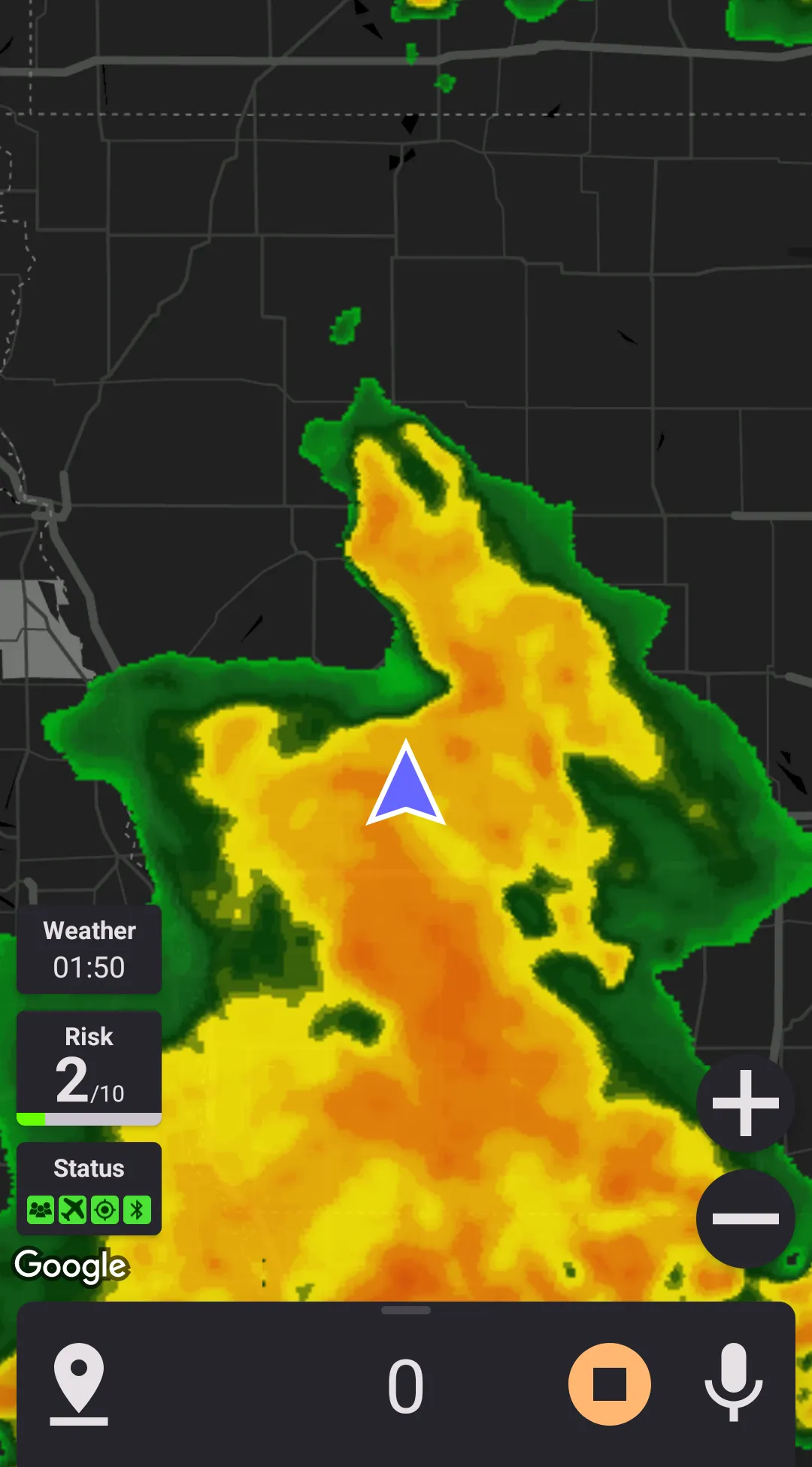
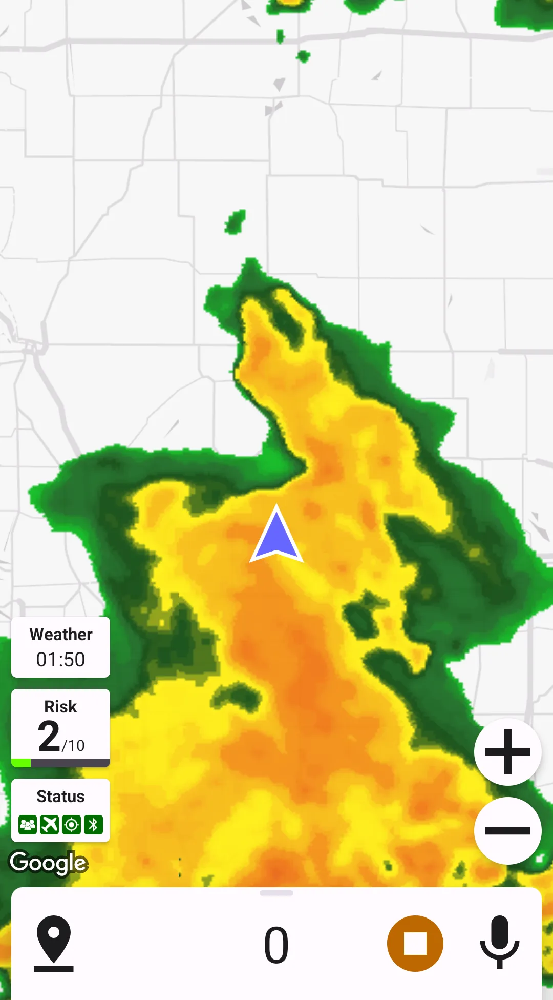
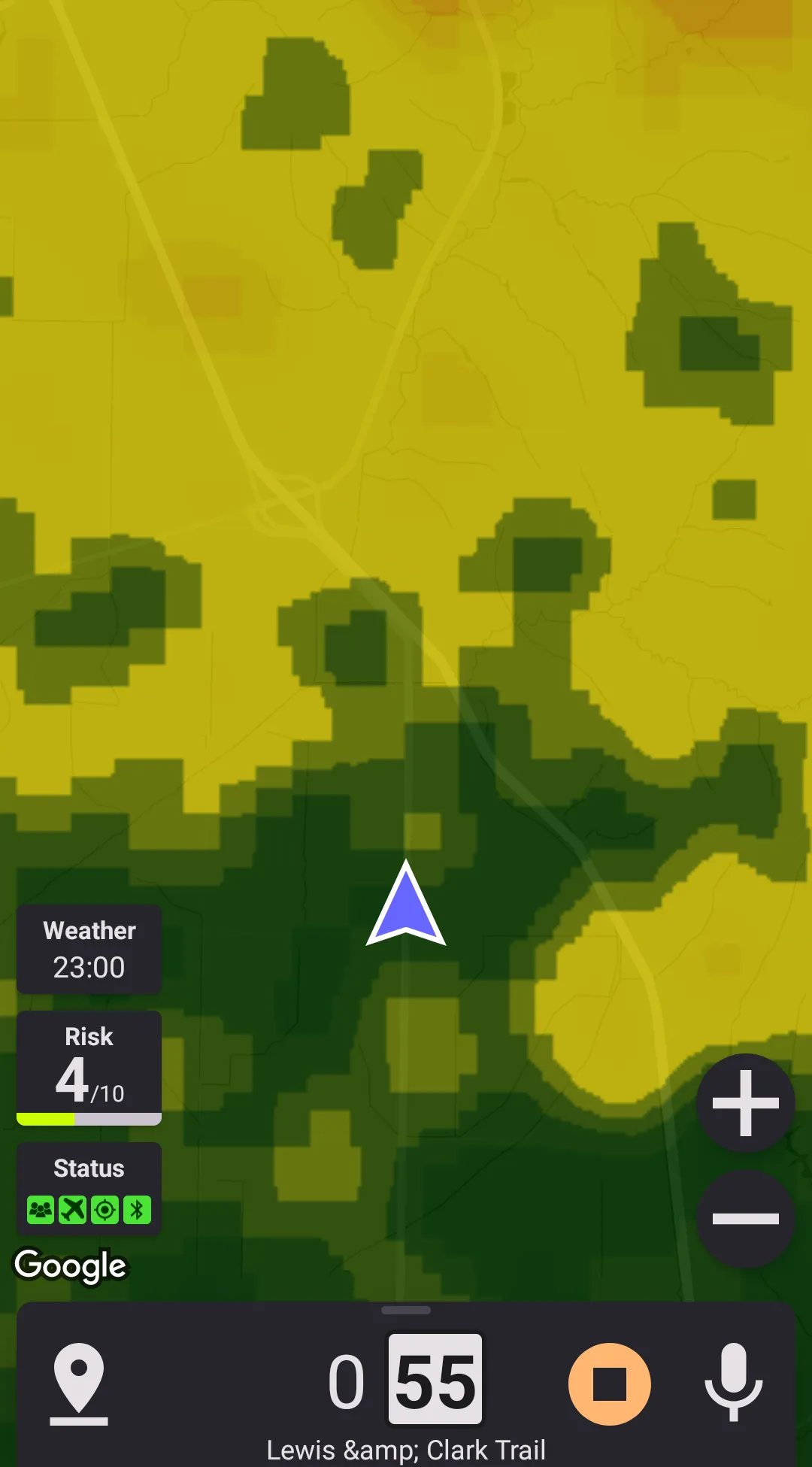
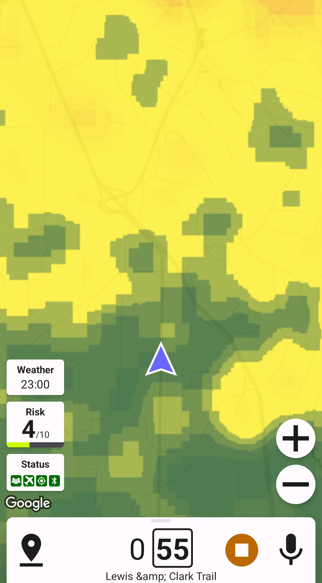
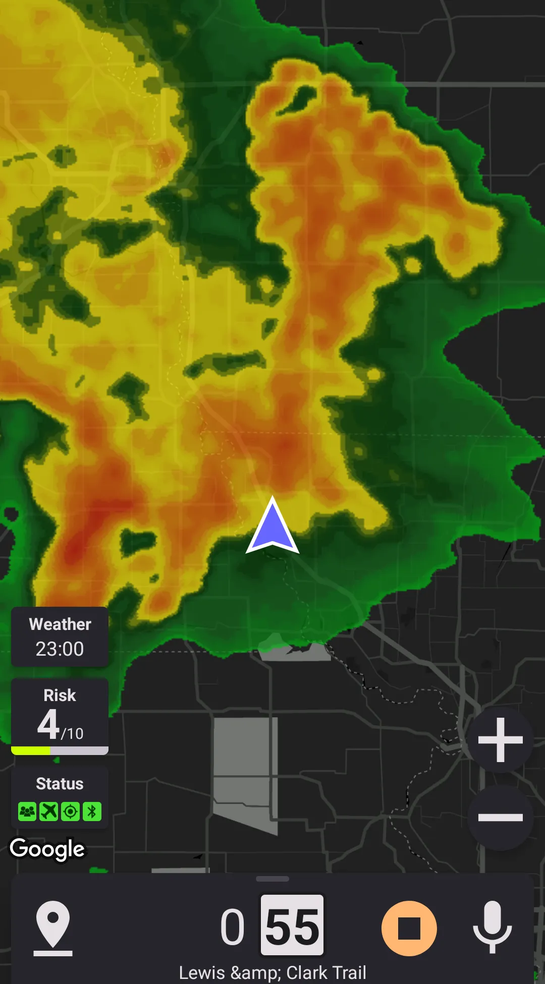
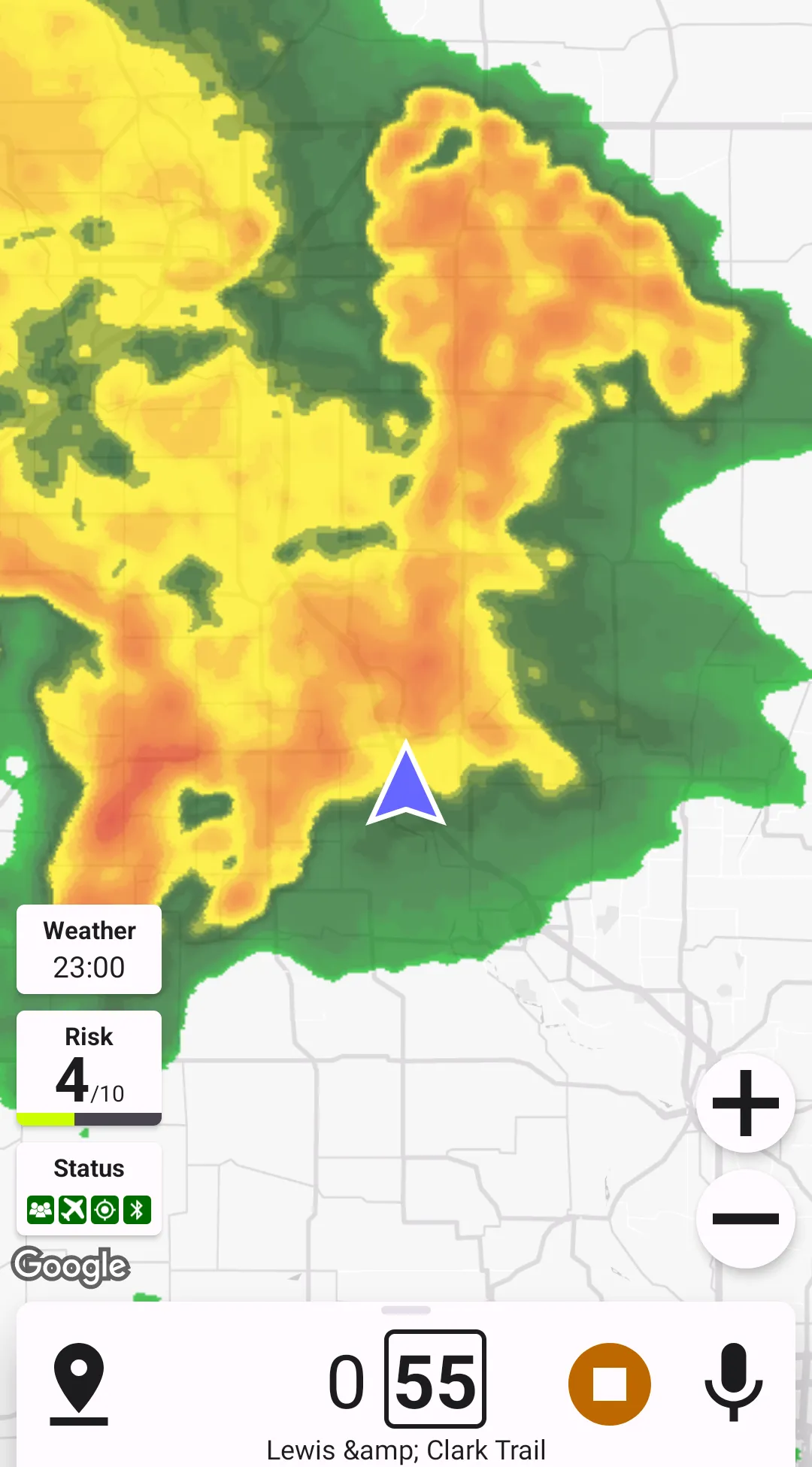
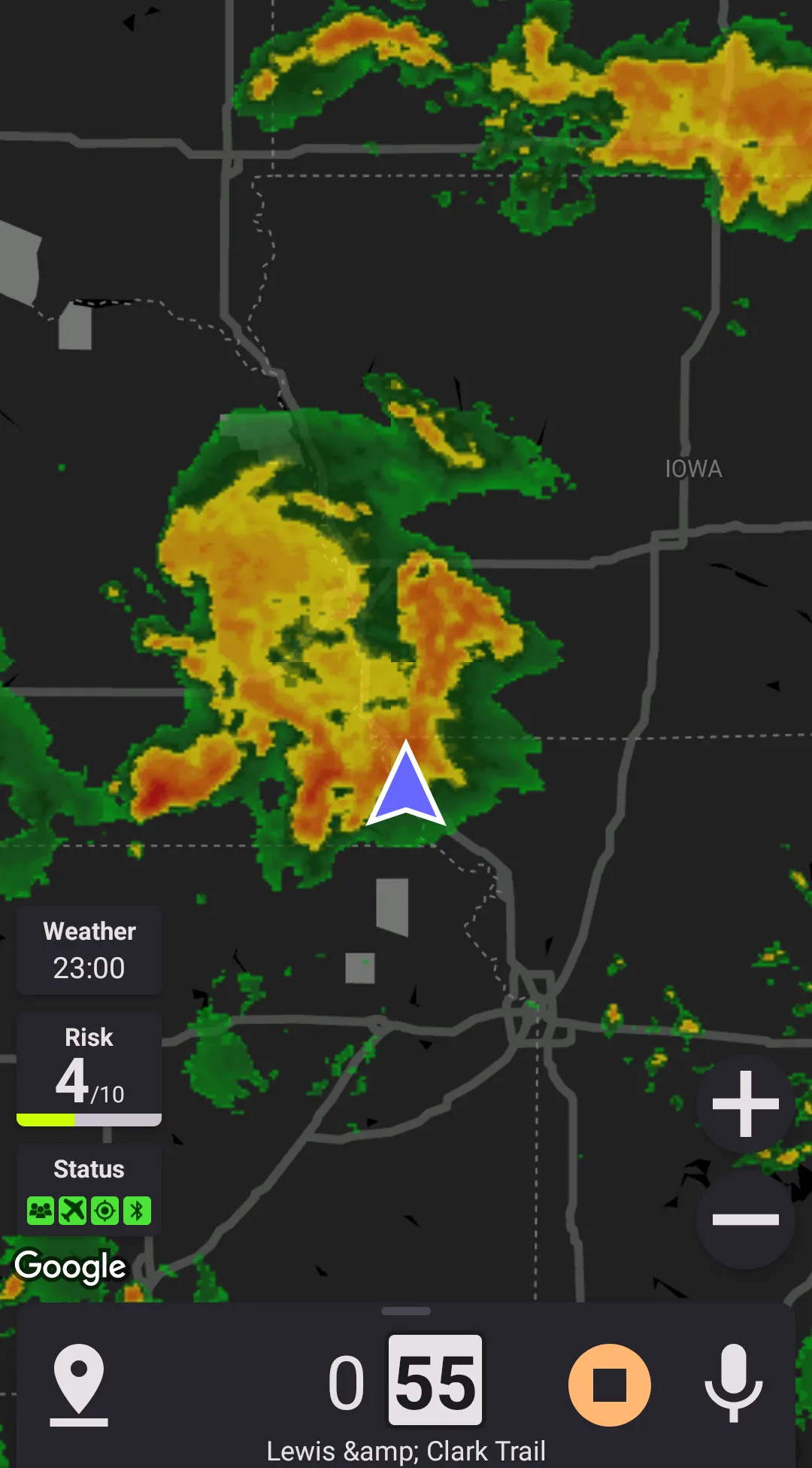
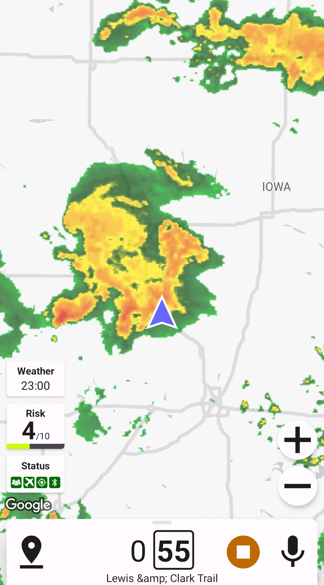
Speed-based weather radar shows the weather data at the time of your arrival to the location. Based on your location and speed, Highway Radar combines multiple forecast layers to show you the radar forecast you're expected to get if you keep your movement speed.
On images below you can see how the multiple forecast layers are combined. Look at the forecast and note a small rain cell on the north-east moving away from your location. It moves at a speed of approximately 20-30 MPH. The weather radar is configured to show you speed-based forecast at 25MPH. If you start moving north-east at 25 MPH you'll be going under that rain cell all the time. The speed-based forecast presents it by showing you green area all the way to the east, as long as it has the forecast data. The arrows on the image show, which forecast layer's data are displayed at corresponding locations (10-, 20-, and 30-minutes forecasts).
This type of radar requires your speed – it can either use some predefined speed, or your historical average speed. If you configure the application to use your average speed for say 10 minutes, then it will compute the "straight-line" distance to your location 10 minutes ago, and divide it by 10 minutes. This means that on curvy roads the displayed speed may be less that an actual one; however, it provides a more accurate speed-based forcast.